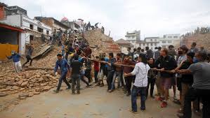
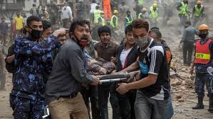
By now we all know the most worrying and trending topic on Nepal – a 7.9 magnitude earthquake on Saturday and its aftershocks over the last weekend. People all over the world have shown their concern for the people of Nepal and have prayed for the casualties. But one cannot deny the bitter truth – Nepal earthquake was inevitable.
The reason for this inevitability lies on the tectonic plate movements of earth’s crust. When these plates hit, brush or move against each other it creates faults and folds. Faults are breaking of rocks resulting from fracture along the edges of Earth’s crust, while folds are bending of rocks due to compression in Earth’s crust. Long years ago when Eurasian and Indo-Australian plates hit each other it resulted in a fold, thus giving birth to The Himalayas. This fold is commonly termed as the Great Himalayan Region.
The recent earthquake was a result of the Indian subcontinent moving northwards. This is inevitable in the Great Himalayan Region. According to a study in 2001, in this region longer the time between 2 big earthquakes, higher the possibility of larger devastation. This puts the whole region and the adjoining Gangetic Plains at high risk.
Although tectonic plates move naturally, land building activities can induce faster movement in them because of pressure on the land. Earthquakes will come in future too, no one can stop that. What we can do is minimize the number of casualties in a disaster by having a disaster mitigation plan for a quake.
Click here for government certifications
 Stay Ahead with the Power of Upskilling - Invest in Yourself!


15 Comments. Leave new
Well written Akul! And yes, it is time we need to make a strategic disaster management plan to optimize our shick absorption capacity!
Thanks for appreciating the article.
Very well explained Akul. 😀
Thank you Kriti.
Very well written Akul.
Thanks Nitesh. Hope you liked it. Thanks for commenting too.
Thank you Nitesh. Thanks for commenting too.
Well written!
Good work…
Thank you Chitranshi and Padma.
We can’t understand their suffering but at least we can try to heal their wounds.
Good job
🙁
Exactly !!
As now the main focus should be on the way to reduce the effects many disaster management techniques, use of GIS to predict,locate & identity the calamities much before the event 😀
Good work 😀
Very nicely written.